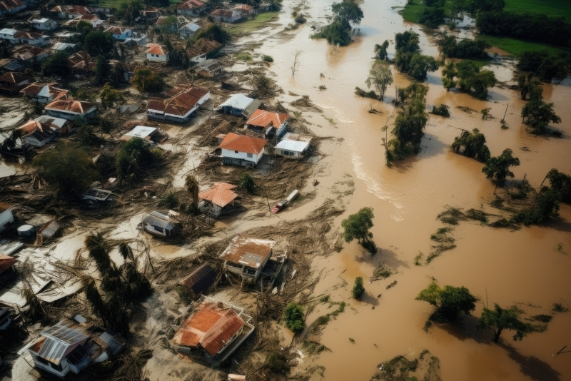
Flood Risk Assessment evaluates the vulnerability of a site or region to flooding using terrain analysis, rainfall data, drainage patterns, and hydrological modeling. Unplanned development and extreme rainfall events increase flood risks, leading to infrastructure damage and economic losses.
Our service assesses flood-prone zones, surface runoff behavior, and water flow pathways to identify potential hazards. Based on the analysis, we recommend structural and non-structural mitigation measures such as drainage improvements, retention systems, elevation planning, and risk zoning. This helps developers, planners, industries, and government bodies make informed decisions, reduce liability, and enhance climate resilience.
We analyze topography, drainage networks, land use patterns, historical rainfall data, and watershed characteristics to understand flood behavior within the project area.
Our team conducts site inspections, verifies drainage conditions, assesses existing infrastructure, and collects ground-level data to validate spatial analysis.
Using rainfall intensity data and runoff modeling, we evaluate flood-prone zones, flow pathways, water accumulation points, and potential vulnerability areas.
We deliver detailed flood risk maps and technical reports along with structural and non-structural mitigation recommendations to reduce risk and enhance resilience.
It helps identify flood-prone zones, prevents infrastructure damage, reduces financial losses, and ensures safer project planning and regulatory compliance.
Infrastructure developers, industries, residential and commercial projects, government bodies, and planners working in flood-sensitive areas should conduct this assessment.
Yes. Many regulatory authorities require flood risk analysis as part of environmental clearance and planning approvals.
While it cannot stop natural events, it significantly reduces risk by enabling informed design, mitigation planning, and resilience strategies.
Clients receive flood hazard maps, risk zone identification, hydrological analysis reports, and mitigation recommendations.