“Tune in to TV9 Marathi this Friday at 3:20 PM for an exclusive session you won’t want to miss”
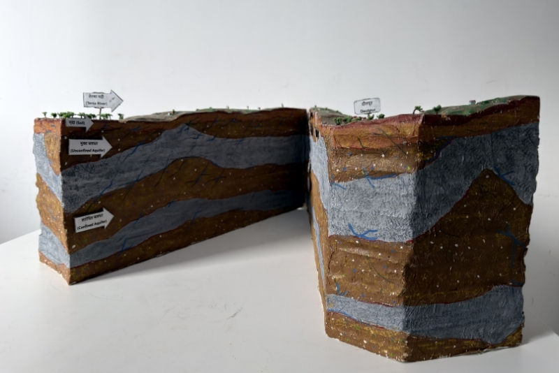
A 3D Watershed Model is a physically constructed representation of a watershed that visually demonstrates both the surface topography and the subsurface geological formations of a region. Developed after detailed surface surveys and subsurface investigations, the model accurately depicts terrain features, drainage patterns, and geological layering beneath the watershed.
The boundary of the model corresponds to the scientifically delineated watershed boundary or village boundary, helping stakeholders clearly understand how water moves across the landscape and within the subsurface. By translating complex hydrogeological data into a tangible visual format, the model becomes a powerful tool for education, planning, and decision-making in watershed management and sustainable water resource development.
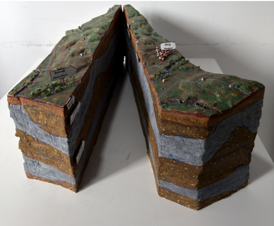
A detailed physical model representing the watershed’s topography, helping users understand slopes, drainage patterns, and natural water flow pathways.
Displays geological layering beneath the watershed, providing insight into subsurface formations that influence groundwater movement and recharge.
Clearly illustrates the scientifically delineated watershed boundary, helping stakeholders understand catchment limits and surface runoff dynamics.
Visually explains how rainfall interacts with terrain, streams, recharge zones, and groundwater systems within the watershed.
A powerful hands-on model designed to support watershed planning, training programs, community awareness, and decision-making in sustainable water management.